

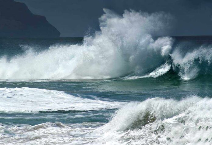
Life-threatening surf and damaging coastal flooding pounded Southern California as Tropical Storm Rachel’s swells, high tides, and onshore winds hit at once.
Story Highlights
- National Weather Service warned of coastal flooding, strong wind, and heavy rain from Rachel.
- National Hurricane Center said Rachel’s waves plus a southerly swell would create deadly surf and rip currents.
- Coastal flooding and flash-flood alerts stretched from San Diego through Los Angeles and Ventura counties.
- Peak risk aligned with Sunday morning high tides above seven feet along Orange and San Diego coasts.
Officials Flag Multiple Hazards, Not Just a Storm Name
National Weather Service forecasters identified the main threats as coastal flooding, wind, and bursts of heavy rain that could trigger flash flooding. They tied the danger to a mix of south and northwest swells, strong onshore winds, and very high tides over seven feet. That blend raised water levels and pushed waves into low-lying beach areas. The warning stressed that the label on the storm mattered less than these forces working together to drive flooding and erosion.
National Hurricane Center experts warned that waves from Rachel, stacked on top of a long-period southerly swell, would produce life-threatening surf and rip currents across Southern California and northern Baja. That marine setup threatened piers, harbor entrances, and beach communities. The center’s advisory explained why even a weakening system could still push dangerous water toward shore. The message was clear: stay off jetties, respect closures, and expect localized flooding near the waterline.
Where Impacts Hit and When They Peaked
Reports showed coastal flooding remained a concern from San Diego through Orange, Los Angeles, Ventura, Santa Barbara, and San Luis Obispo counties. Inland, flash-flood warnings were issued for parts of San Diego, Riverside, and Imperial counties as deep tropical moisture spilled over foothills and deserts. Forecasters highlighted Sunday morning as the highest-risk window, when swells, onshore winds, and the strong high tide combined to push water into streets and across beaches along Orange and San Diego coasts.
Local governments took action as conditions worsened. Coastal flood warnings and advisories expanded. Crews closed some beaches and handed out sandbags in known hot spots. Newport Beach declared a local emergency and shut its piers to keep people out of harm’s way. These steps matched the risk picture, which featured pounding shore break, quick run-up, and rip currents near key access points and low-lying neighborhoods along the coast.
What This Means for Families, Property, and Public Safety
Emergency managers urged residents to treat this as a water event first. Water moving over sand and into roads causes most injuries and damage in these setups, not extreme wind. Drivers were told to avoid flooded streets, as even shallow water can stall a car or hide sinkholes. Beachfront owners were advised to secure items and prepare for erosion. Swimmers and surfers faced severe rip currents and shifting sand bars, which can trap even strong swimmers near jetties and piers.
The record also underscores a common communication gap. People often focus on a storm’s label—hurricane, tropical storm, or remnants—while the real risk rides with tides, swell period, and wind direction. Rachel’s status changed as it weakened, but the hazards did not fade at the same pace. That is why agencies emphasized the timing of tides and the long-period swell during the weekend rush at local beaches and harbor areas across Southern California.
Context: Rare, But Not New, Tropical Impacts in Southern California
Southern California rarely sees direct landfalling tropical cyclones, yet the region does face serious rain and surf from weakening systems that pass nearby. Past events have shown this pattern. Former storms have delivered flooding, power outages, and large waves after their peak winds were long gone offshore. That history explains why officials focus on water threats, including flash flooding inland and coastal flooding from set-up, swell, and tide alignment during these events.
Orange County California – Coastal Risk Analysis and Forecast
Afternoon surf confirms a sharply split Orange County event: large at exposed North County breaks, much smaller in South County.
Forecast issued: Sunday, October 11, 2026 — 3:30 PM PDT
Current risk: HIGH for…— OC Beach Status (@OCBeachStatus) October 12, 2026
Authorities cautioned that a full damage tally will come later. Early accounts described flooded streets, battered beaches, and emergency closures to protect life and property. The best course now is simple and practical: heed local closures, avoid flooded roadways, and keep clear of piers and jetties until tides drop and surf subsides. Families who live near the water should keep sandbags in place and watch the next high-tide cycle in case the swell persists into early week.
Sources:
feedpress.me, latimes.com, nhc.noaa.gov, forecast.weather.gov, abcnews.com